
Pacaya National Park and its visitor setting
Understand the protected-area identity and Calderas context. Use official park information while confirming current facilities, entry and permitted routes.
Last reviewed October 2026
Contents8
- Pacaya national park in the official listing
- The volcano and the protected area are distinct outlines
- What Calderas in the name tells you
- Facilities described and facilities available now
- Current rules need a current answer
- Photos as context for the place
- Before arranging a park visit
- Verdict: use Pacaya national park as context, then confirm the visit
Pacaya national park is the park setting for a visit to the volcano, with Laguna de Calderas included in its official name. That name does not mean a walking tour visits both places or allows access throughout the area. Confirm the actual route and services, with the entrance for your date. A general tourism listing is not a current access notice.
In brief: distinguish the protected area from the volcano and from a tour package. Use the official listing for identity and context. Ask apart about open routes and facilities, plus payment before making a visit plan.
Pacaya national park in the official listing
The CONAP tourism listing names the Parque Nacional Volcán Pacaya y Laguna de Calderas. Its location fields name Amatitlán and San Vicente Pacaya. The departments listed are Guatemala and Escuintla.
We checked the listing in October 2026. It is an official source for the listing. Our guide does not run the park.
The listing names INAB, the Instituto Nacional de Bosques, as manager. We report what the listing says. It does not confirm every current service or role. If you need an access rule, obtain the answer from the responsible park staff. A guide or commercial seller can have a separate role in your booking.
| Listing fact | Published details | Source context |
|---|---|---|
| Protected-area name | Volcán Pacaya y Laguna de Calderas | CONAP tourism listing |
| Municipalities | Amatitlán; San Vicente Pacaya | CONAP location fields |
| Departments | Guatemala; Escuintla | CONAP location fields |
| Declaration year | 1963 | CONAP listing, checked October 2026 |
| Manager named | Instituto Nacional de Bosques, INAB | Listing attribution, not a new legal finding |
Scroll for more →
Do not turn those fields into an access schedule. The declaration year is part of the park's history. The manager field gives the listing's contact context. Neither fact alone says which visitor path is open today.
The volcano and the protected area are distinct outlines
A volcano is a geological subject. A park has an official name and boundary. A tour sets out services and a schedule. Those three things can overlap without matching exactly.
The Smithsonian Pacaya record describes the volcanic complex. It does not draw the park's visitor permissions. Its main coordinate marks a science record, rather than a gate. Use the allowed route given for your actual visit.
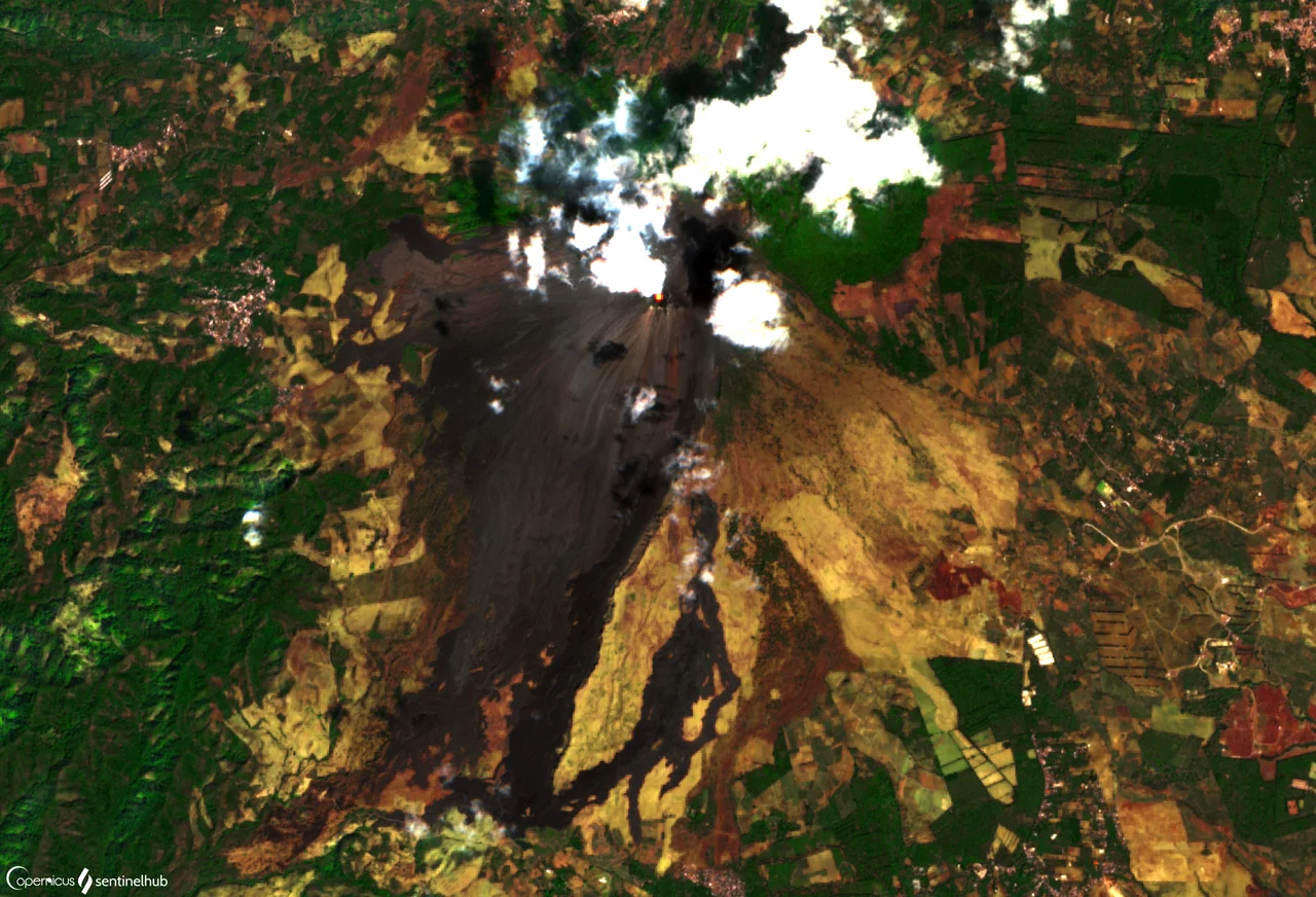
We have not confirmed a current official boundary to plot here. The image is a past satellite view, with its processing explained in the caption. It is not a boundary map. Do not infer that every visible field or path lies within a visitor area.
The distinction matters when a map app offers a pin called Pacaya. It may mark the volcano or a service nearby. Ask what the point represents before using it as an arrival address. A broad place label is not enough to coordinate a driver and guide.
What Calderas in the name tells you
The lagoon belongs to the official protected-area name in the cited listing. That helps explain the wider place. It does not establish that the standard volcano walk includes lagoon access. Ask whether your trip visits it. Check what extra plans it needs.
Do not add an unplanned lagoon stop based only on the park name. The seller may have a distinct route and a fixed return. A place can be nearby without fitting into the booked day. Confirm the complete sequence before treating it as included.
This guide does not publish unconfirmed lagoon facilities or activity prices. Nor does it turn Calderas into a separate destination trip plan. The task here is to understand the protected area's identity. Your visit should still follow a named and allowed plan.
Facilities described and facilities available now
CONAP's listing refers to a visitor centre and viewpoints. That helps explain the type of visitor setting it describes. It does not confirm that each facility is operating when you arrive. Ask the seller which services are available on your date.
Check any item you depend on. That can include toilets, food or a place to leave luggage. A mention in an old account does not reserve the service. Carry the supplies agreed for your walk rather than assuming you can buy them along the way.
If gear is offered for rent, ask whether it is held for your group. Confirm the terms and an alternative if it is unavailable. Essential footwear or lighting should not depend on a guess. A rental photo does not prove current stock.
Current rules need a current answer
The listing contains general visitor details and a published schedule. We have not confirmed that schedule as the rule for your specific route and date. An early or late walk needs its own permission check. Do not use a broad listing to justify a pre-dawn or after-dark visit.
The same care applies to entry and guides. Ask for the current charge and the requirement that applies to your party. A supplier's inclusion list can explain its package but cannot replace the park rule. Keep entry and guiding, plus transport separate in the total.
The hiking guide brings those practical questions together. It distinguishes a visitor endpoint from the summit. A past tourism route may describe access that is not allowed now. Follow current instructions rather than trying to repeat an old account.
Photos as context for the place
The satellite image here was captured in January 2019 and uses infrared highlighting, as the caption explains. It gives a past landscape-scale view. It is not an ordinary eye-level photo or a current activity report. The colours draw attention to some features. It is not what you see with your eyes.
The picture guide separates views, rock samples and past activity. The real images have their own credits and licences. Each has a source and date context. Use those pictures to understand subjects, not to infer permission. A clear view of a feature does not make it an available visitor stop.
Before arranging a park visit
- Name the entrance and the actual route for your date.
- Confirm the guide and entry plans apart.
- Ask about any facility or gear you will rely on.
- Check whether a lagoon stop is actually in the trip plan.
- Agree on the walking finish and return vehicle meeting.
- Ask how current instructions can change the plan.
Keep the seller's answer with the booking. If the route changes, ask how the revised day works before starting. A shorter walk still needs a clear return. Do not assume the protected-area name fills in missing service details.
Continue with these guides
Verdict: use Pacaya national park as context, then confirm the visit
Pacaya national park describes more than a single summit point. The official listing names the park and its link with Calderas. Current access and services require their own answers. The Pacaya overview connects the place with the main choices for a visit.