
Pacaya volcano pictures with dates and context
Explore licensed real Pacaya photographs with dates and source context. Separate landscape, rock samples, satellite views and historical eruptions.
Last reviewed October 2026
Contents12
- Pacaya volcano pictures: start with the caption
- The wider volcanic landscape
- Fog and past visitor context
- A scoria sample is not a trail surface
- Pacaya volcano pictures of past eruptions
- A view from Guatemala City
- The satellite image and its colours
- Past heat is not a live promise
- What the gallery does not document
- Taking your own photos on an allowed walk
- Image rights and source corrections
- Verdict: read Pacaya volcano pictures with their records
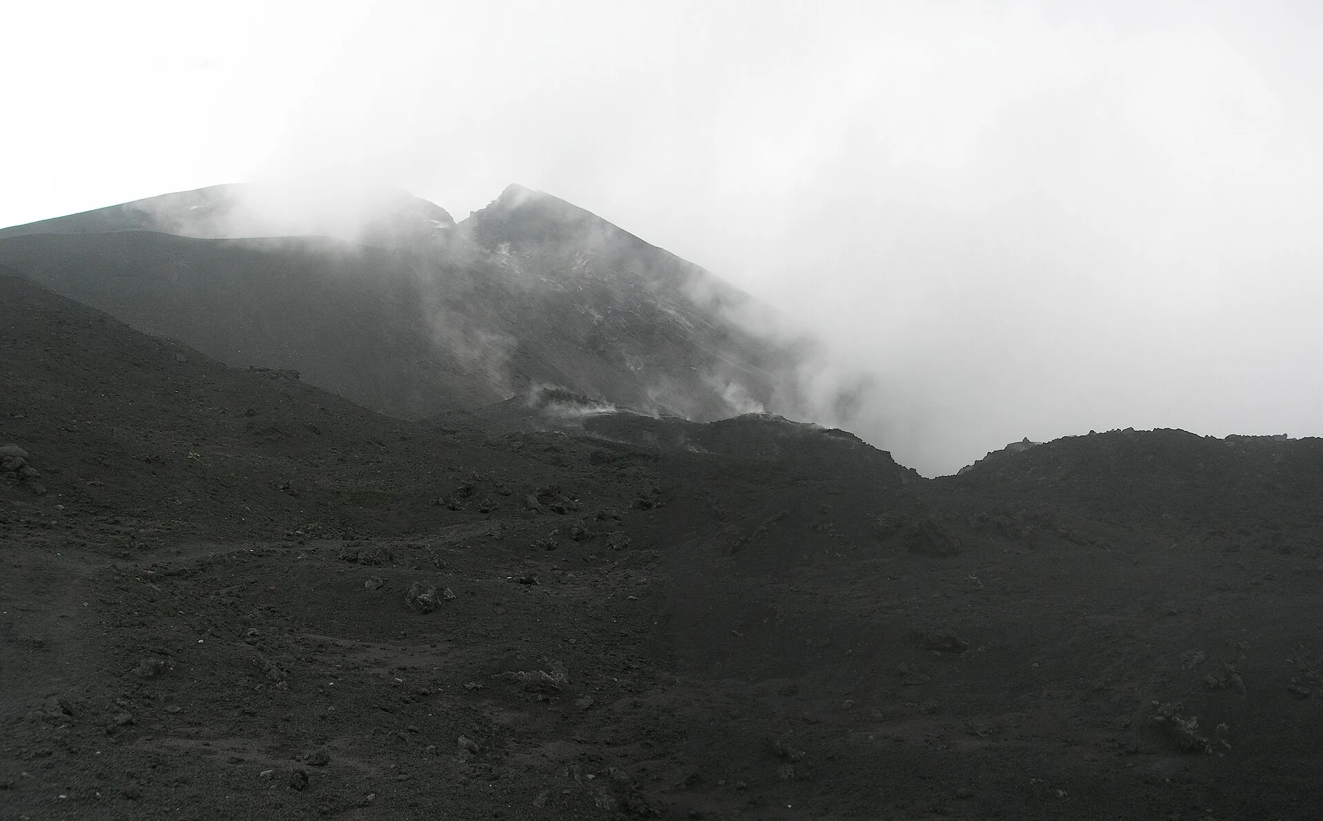
2012-08-17 · Historical view near the caldera. It is not a current route or activity image. Converted to WebP.
Nolabob · CC BY-SA 3.0 · Image source

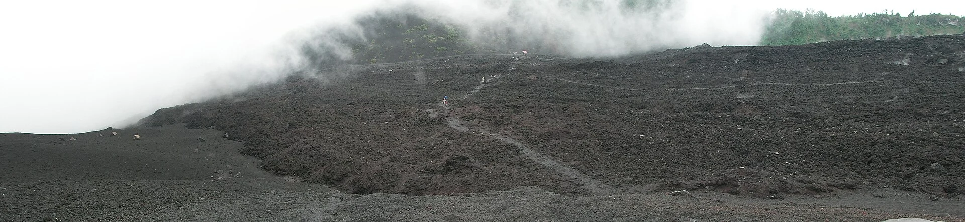
2012-08-17 · Historical landscape context. Visible ground does not establish access. Converted to WebP.
Nolabob · CC BY-SA 3.0 · Image source

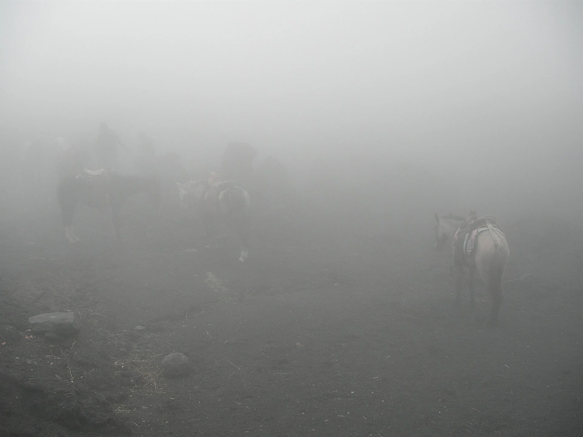
2012-08-17 · Historical visitor landscape in fog. It does not establish current path conditions or animal-service availability. Converted to WebP.
Nolabob · CC BY-SA 4.0 · Image source

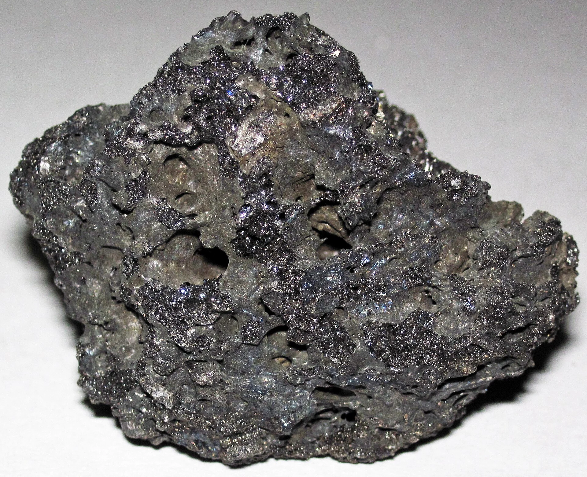
2020-12-11 · Photograph date. The source says the sample was collected in December 2004; this is not an in-place trail surface. Converted to WebP.
James St. John · CC BY 2.0 · Image source
_1.jpg)
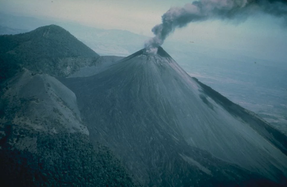
1976 · Historical USGS photograph. The year is the available capture precision; it is not a present warning. Converted to WebP.
USGS · Public domain · Image source

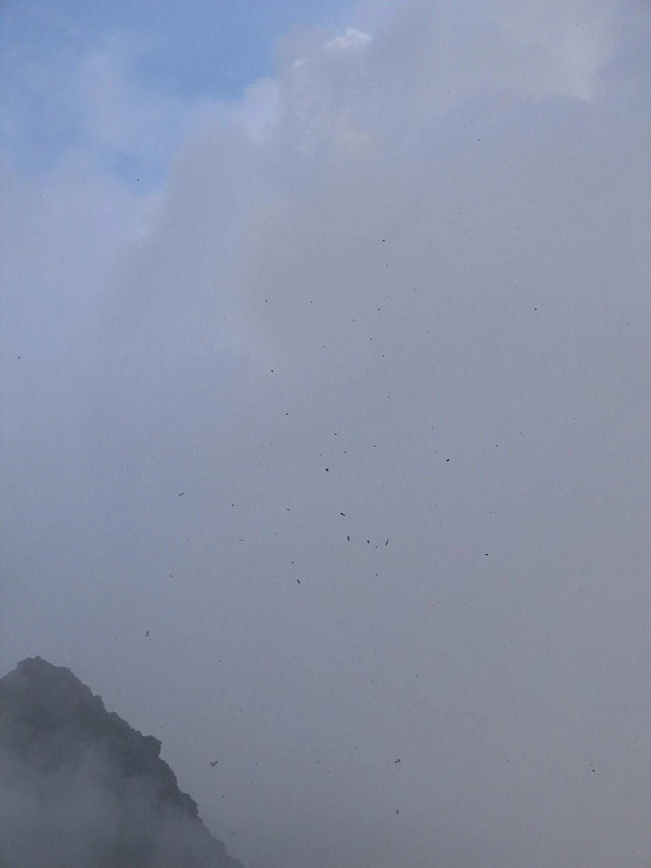
2005-03-05 (EXIF) · Date according to the source EXIF record. The image does not give a permitted viewing distance. Converted to WebP.
Peter Andersen · CC BY-SA 2.5 · Image source

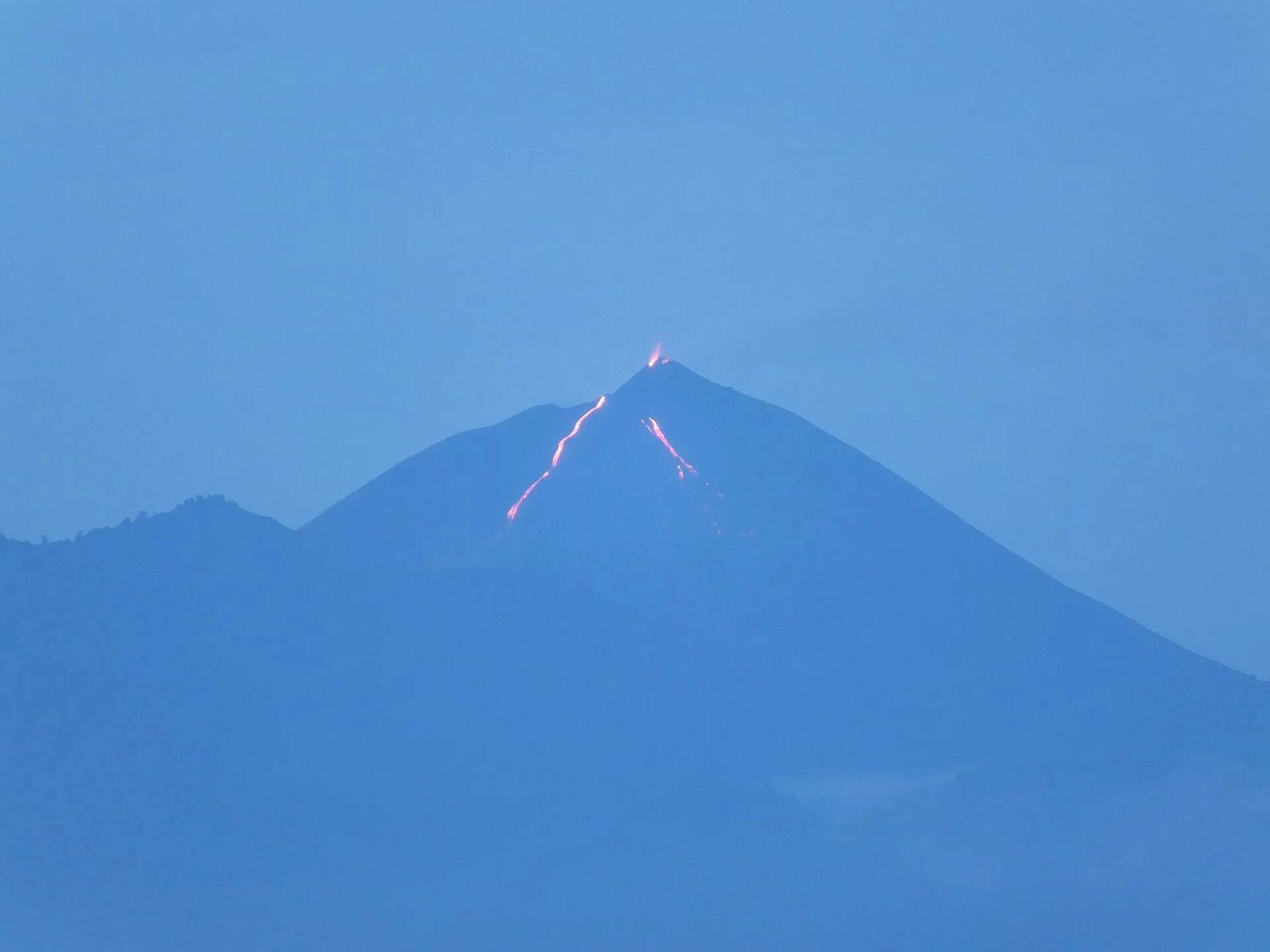
2020-09-04 · Historical view from the city, not a trail viewpoint or current lava report. Converted to WebP.
Luisfi · CC BY-SA 4.0 · Image source

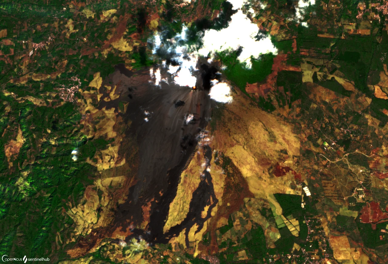
2019-01-30 · Capture date from source description. True colour with IR highlights; not direct natural vision. Contains modified Copernicus Sentinel data (2019). Converted to WebP.
Monja Šebela / SentinelHub; contains modified Copernicus Sentinel data (2019) · CC BY 2.0 · Image source

These Pacaya volcano pictures are a dated visual guide, not a live view of the mountain. The gallery uses licensed real images with source links and credits. It separates the wider landscape, a rock sample and past activity. Open an image for a larger view, then read its caption before using it to form expectations for a visit.
In brief: keep place, capture date and subject together. A real old eruption photo can be accurate without showing current activity. A satellite image can reveal landscape patterns while using colours that differ from natural vision. None of these images establishes today's visitor route.
Pacaya volcano pictures: start with the caption
A useful picture record tells you where the camera was and what the image is meant to show. It also gives the capture date if known. The date a file was uploaded is not automatically the date of the scene. Read each field on its own when the source supplies both.
The gallery includes ground-level views and a satellite view. They work at distinct scales. One helps you see texture or a specific scene; another shows a wider landscape. They should not be treated as interchangeable evidence for a walking route.
Every gallery image has a visible credit and source link. Follow that link if you want to inspect the source description. The licence link explains the reuse terms where a licence applies. Public-domain material is labelled as such rather than assigned an invented licence.
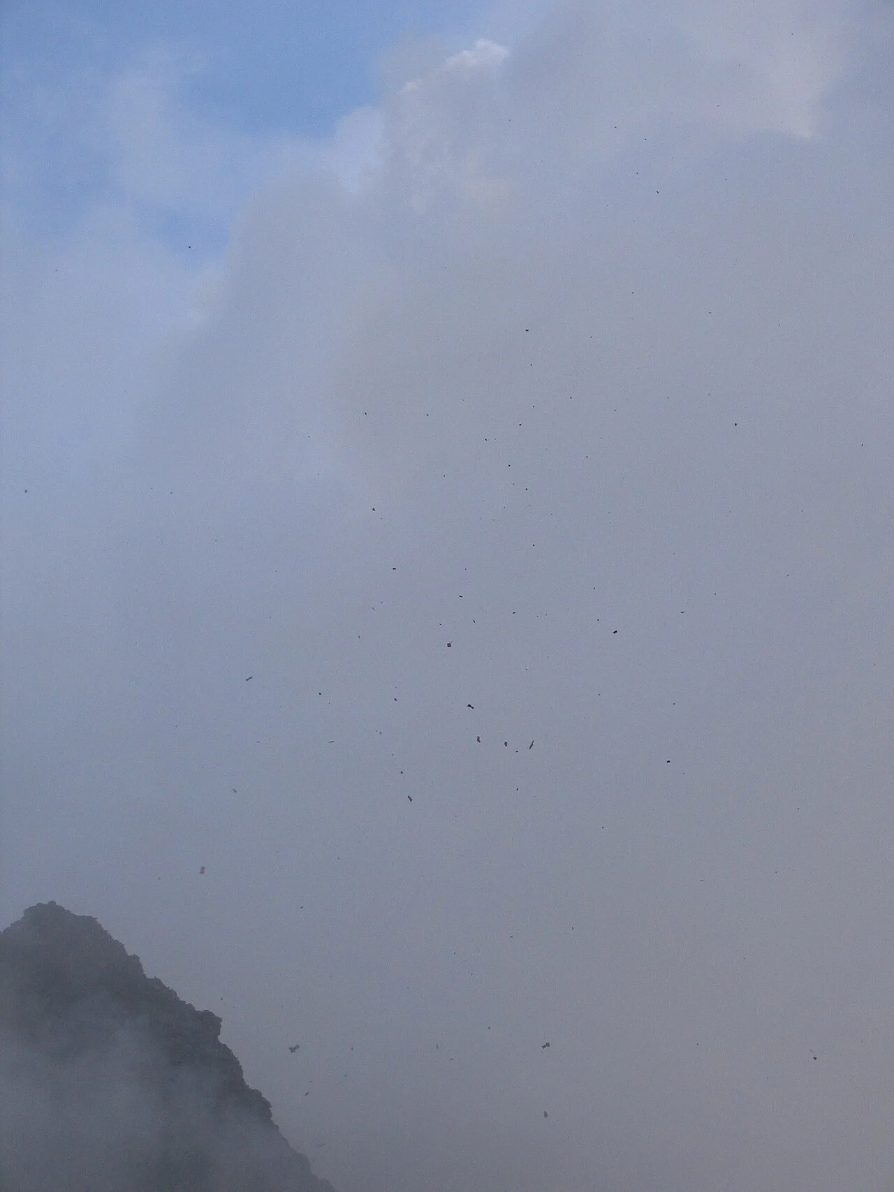
The opening image is Peter Andersen’s 2005 photograph of ejected material. Read that past event alongside the wider landscape views in the gallery. The image does not establish a current walking route or viewing distance. Keep its capture date with the picture when comparing it with your plans.
The wider volcanic landscape
The panoramas by Nolabob were captured in August 2012 according to their Commons records. They show a past view near the caldera area. Use them to recognise the scale of slopes and cones in a volcanic setting. Do not read the visible ground as the route a guide will take today.
A wide view can make separate forms appear close together. The lens and the camera position affect their apparent size. A distant ridge can be hidden by a nearer one. This is why a landscape photo should not be used to assign a geological name to every visible shape.
The Smithsonian Pacaya record supplies the geological context beyond the image. It describes a complex with named features. The type guide explains that classification in plain language. Use the source account alongside the view rather than identifying type from silhouette alone.
The photo may show a real place while leaving its exact viewpoint uncertain. A broad source description should remain broad. We do not invent a named visitor platform to make the caption sound more precise. A narrower claim needs better evidence.
Fog and past visitor context
The foggy Pacaya image is also dated August 2012 in its source record. It includes a past visitor landscape and animals. It does not confirm today's visibility, path condition or availability of animal services. The caption preserves those limits.
Fog can hide the larger scene while leaving nearby details visible. A picture taken in those conditions is not a weather forecast for another day. It shows what was in front of the camera at that time. Make a separate current forecast check when planning a walk.
Do not assume that gear or services visible in a past image are included in your booking. A horse in a photo does not reserve one. A path with people on it does not prove current permission to use it. Ask the actual seller about the date and route you are considering.
Past visitor images are still useful. They help show that a mountain trip is more than a clear summit view. They can prompt questions about pace, clothing and what happens under cloud. Those questions should lead to current answers rather than a prediction based on one photo.
A scoria sample is not a trail surface
James St. John's close-up shows a documented Pacaya scoria sample. The photo date is in December 2020, while the description says the sample was collected in December 2004. These are distinct dates for distinct events. Neither should be presented as the date of a current walk.
The close view is useful for texture. It is not an in-place photo of the surface under a visitor's feet. A specimen can be framed and lit in a way a landscape cannot. Avoid using its scale or colour to predict an entire trail.
A rock sample and a wide landscape answer distinct questions. The sample can show material detail. The panorama can show shape and setting. Neither alone explains the full geological history of the complex.
Do not remove or collect material to reproduce the image. The gallery is an observation guide, not a collecting trip plan. Current park instructions remain separate from a specimen's source record. You can learn from a close-up without seeking the collection point yourself.
Pacaya volcano pictures of past eruptions
The USGS photo dated 1976 shows an ash-producing eruption. Only the year is supplied at that precision in our source record. We do not invent a month or day. It is past evidence, not an alert about the conditions of your visit.
The image credited to Peter Andersen has an EXIF-based date in March 2005. Its source describes ejected material at Pacaya. That date is reported with the stated EXIF basis. The frame does not tell you a permitted viewing distance or a current route.
Keep the photographer's position separate from the subject. An eruption may be photographed from a distinct place than a tourist walk. A long lens can compress the apparent distance. Do not infer how close someone stood from the size of the feature in the frame.
The gallery does not combine these images into a new event chronology. Each belongs to its own date and source. Two dramatic frames placed next to each other need not show the same episode. Read them individually before drawing a past conclusion.
A view from Guatemala City
Luisfi's dawn photo is dated September 2020 in the Commons record. It is a real view towards Pacaya from the city. It gives a distinct relationship between observer and volcano from the near-landscape images. The caption names that viewpoint context.
Seeing lava activity from a distant city does not show access to the feature. It does not prove the same glow will appear during a future hike. The frame also does not establish a road or walking distance. It is a view with a date, not a trip measurement.
Light and exposure matter in dawn and night photos. The visible glow can dominate while the surroundings remain dark. That does not make the image false. It means the conditions and technique are part of reading it.
When a seller uses a similar image, ask what the booked trip is expected to show. Keep that answer separate from the past picture. A landscape walk may remain worthwhile without matching the frame. Your choice should reflect the actual offered experience.
The satellite image and its colours
The Sentinel-2 view was captured in January 2019 according to the source description. It uses true colour with infrared highlights. The credit includes the modified Copernicus Sentinel data and processing attribution. This is a processed satellite image, rather than an ordinary eye-level photo.
The highlighting is part of the image's method. A bright area should not be treated as the exact colour a person would see from a trail. The source explains the treatment, which should stay with the image. Removing that context can turn a useful visual into a misleading one.
The view helps show the relationship between volcanic ground and surrounding land at a broad scale. It does not draw the national park boundary. It does not mark open paths or safe areas. A visible track-like line is not automatically a visitor route.
Do not use the image to navigate to a feature. It belongs to a past capture date, and it has no current access layer. Ask for a confirmed entrance and allowed endpoint. A satellite view and a route instruction serve distinct purposes.
Past heat is not a live promise
The gallery includes activity images because they are part of Pacaya's history. It does not claim that red lava or ash can be seen on demand. A current activity question needs an actual dated monitoring report. An old photo cannot replace that source.
Nor does a dark surface prove that it is cool or suitable to approach. This guide does not provide a method for judging heat from an image. Keep to the current route and instructions. Do not try to recreate an old frame by moving towards an opening or flow.
If a feature in a photo is essential to your booking, ask about it before paying. The seller should explain uncertainty and the alternative if it is unavailable. Do not quietly turn a possibility into a promise. Decide whether the rest of the walk meets your interests.
What the gallery does not document
It is not a complete record of every Pacaya feature. It does not certify current trail condition or visitor access. No image here is presented as a live camera feed. The range is chosen to explain distinct kinds of visual evidence.
The gallery also does not name every ridge or patch of ground in the panoramas. A specific label needs source support. Where the description is general, the caption stays general. This avoids giving a precise name to a shape that the record does not establish.
There is no claim of first-hand photography by our editorial team. The named photographers and sources are credited. The source description and capture context remain visible. These records allow the reader to inspect the basis of each image.
Taking your own photos on an allowed walk
Ask the guide where the group may stop and how long the stop lasts. Keep picture-taking within that plan. A better angle should not require leaving the allowed route. Accept that cloud or a changed endpoint may produce a distinct scene from the one you saw online.
Carry the camera so it does not interfere with walking. Keep a way to protect it from the weather you have planned for. A photo stop still needs a return and a meeting point. Do not make the rest of the group guess where you went for a shot.
When keeping your own record, note the date and subject. If you do not know a feature's name, use a general description. You can check it later rather than guessing in the caption. A modest accurate record is more useful than a precise invented one.
The hiking guide explains the route and pace questions behind those stops. The photo is one part of a day on foot. Make the walk workable before planning a series of images. Gear cannot grant access that the route does not allow.
Image rights and source corrections
Each gallery caption links to the Commons source and names the applicable licence or public-domain status. Our local copies have been converted to WebP. That change is stated rather than suggesting the original file is untouched. Check the original licence before reusing an image yourself.
Credit is not the same as permission for every possible reuse. The licence terms still matter. Follow the source record rather than assuming all pictures on a website have the same rights. The gallery includes several distinct licences.
If you find a caption error, name the image and the source detail that needs correction. A more precise capture date should come with evidence. A current view does not erase the meaning of a past one. Corrections should improve the record while keeping its dates intact.
Continue with these guides
Verdict: read Pacaya volcano pictures with their records
Pacaya volcano pictures are most useful when place, date and subject stay together. This gallery offers past views and source context, not a promise of today's display. Use the Pacaya overview to connect those images with the wider place. Check the actual walk in its own right.